
Home >> Glamping >> Activities
Local Area | Walking | | Cycling | Clay Shooting | Trout Fishing | Bushcraft and Woodland | Wild Camping | Dogs
Local Area | Walking | | Cycling | Clay Shooting | Trout Fishing | Bushcraft and Woodland | Wild Camping | Dogs
Walking at Meon Springs
|
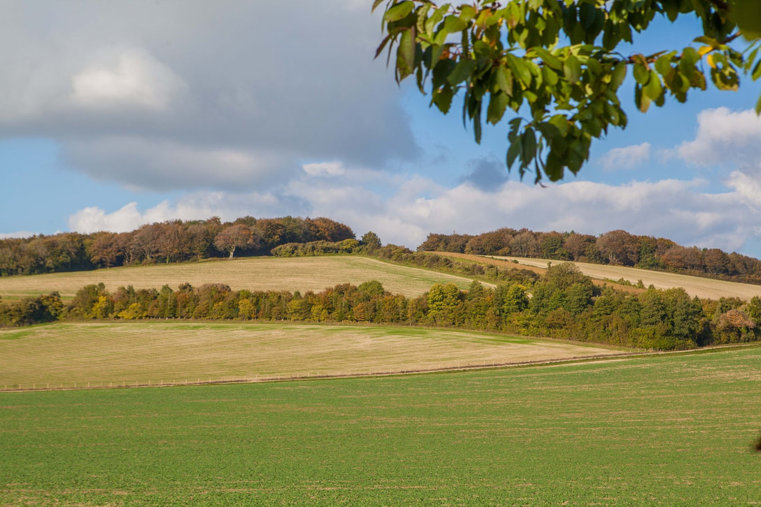
Hampshire and the South Downs National Park are a magnet for walkers and cyclists alike. There are plenty of places for you to explore on foot - from a quick walk around the block to a more adventurous hike along one of the many trails. Whether you want a relaxing stroll or something more energetic, here's a couple of suggestions for you.
If you can read a OS map then you'll be able to find your way around no bother at all. But if you're a bit more high tech, then the easiest way to navigate these days is from your mobile phone. For each walking route, we have uploaded a Gpx file that you can load onto your phone. This will give you a route that you can easily follow. |
|
|
|
an overview of the area
|
Area Map
This pdf gives you a map of the general area, within a few miles of Meon Springs. Whitewool Farm & Points of Interest This map shows you the boundaries of Whitewool Farm and points of interest, i.e. The Nature Trail (Gpx Route) and location of Geocache on the farm. our most popular routesRound the Block
This is the first route that you should do. It is a couple of easy miles around the valley bottom, taking in the dairy farm and the fly fishery lodge. Gpx route To East Meon This is a description of the quickest route to East Meon Gpx Route To West Meon This is a description of a semi off road route to West Meon - Gpx Route East Meon and Drayton A simple circular walk, taking in some good views, the local village and a bit of woodland. - Gpx Route This will get your heart pounding a bitPeake Farm and Old Winchester Hill
A good circular walk, over the South side of the Downs. Unfortunately no pub, unless you detour (recommended) to The Shoe at Exton. Gpx Route The Bat & Ball A good walk to a good pub, taking in the cafe at The Sustainability Centre on route. - Gpx Route a proper hikeThe Twin Peaks
This route is 10 miles long, taking in The Roman Hill Fort on Old Winchester Hill and Beacon Hill as well as two villages, Warnford and Exton, each with its own pub. It has superb views across the South Coast. - Gpx Route Butser Hill A walk to the highest point on the South Downs Way. 10 miles, with one café on the way out and the village of East Meon on the way back. Gpx Route |
Installing the tech...Getting started is as easy as 1, 2, 3... 1. If you don't already have an app that will read a GPX file. Try: Android - install GPX Viewer by Vectura Games (there are others but this is the best we know). Apple - try GPX Navigator Windows - GPX Viewer by Green Lake Studios 2. Click on the GPX route link by the walk that you wish to do. 3. The route should open up in the app. Follow it and have a fun day, knowing where you are at all times. Alternatively, if you don't have a smart enough phone, you can simply download the route and print it off at home. Or have a word with the guys in the fishery lodge, and they'll print one for you. 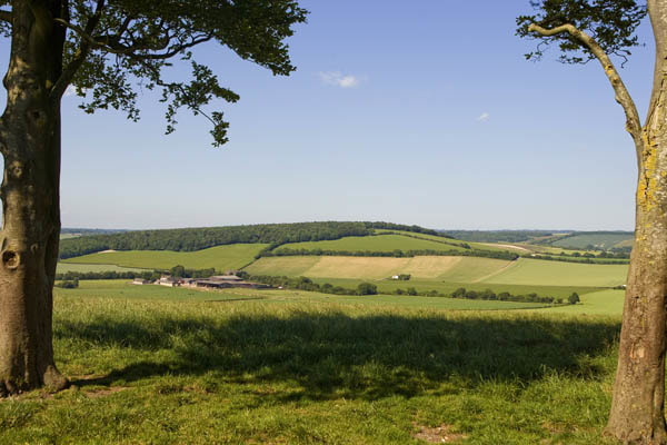
|